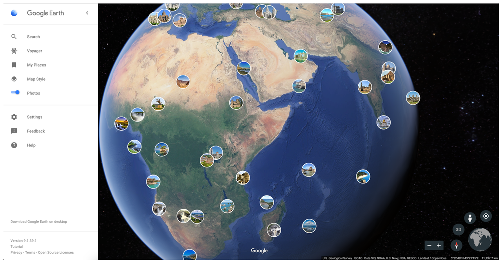
The photos layer is basically a crowd-sourced collection of pictures. You can tap on the lenses and view at places from other people’s perspective. In order to make use of this newly introduced feature, you would have to switch on the photos toggle which would enable this layer. The layer can be switched on from the side menu on the left. It is located just below map style and can be switched on or off. Switching it on would pop up a number of lenses on your map which will be relevant places of interest. Clicking on any of these would result in a full-screen photo being opened after which you could swipe through and take a look at all the recent photos shared in that location. The photos get added automatically from Google Maps. Basically, every time a contributor or a local guide adds a photo to a location in Google Maps, Google’s machine learning algorithm will go through it. If it’s a relevant photo of the place you are at, it would automatically be featured on Google Earth. If you have ever submitted a photo to Google Maps in the past, we suggest you check out this new Google Earth feature and look for your photos over there. The update is live for all users already and can be accessed from the Android app, the iOS app as well as the web version of Google Earth. This is an interesting feature and would help the users plan their travel, as well as get a good idea about places without having to leave their couch! Try it out today! Source: Google Blog